Adventure
Paragliding on the Garden Route: launch sites, tandem flights and when to fly
Wilderness is one of the most flown stretches of coast in Africa. Here is where people launch, what the wind needs to do, and how to get in the air if you have never flown before.

The Map of Africa launch is right next to our land, about 220 m from the cottage.
Kurz gesagt
The Garden Route around Wilderness is one of South Africa's best-known paragliding areas, with more than 20 sites within an hour's drive. The main coastal sites are the Map of Africa above Wilderness, Kleinkrantz and Paradise Ridge east of the village, and Sedgefield. Most coastal sites fly in south to south-easterly sea breezes. Tandem flights for beginners start at around R850 with one of several local schools, and the coast between Wilderness and Sedgefield is South Africa's hotspot for learning to parakite.
- Main sites
- Map of Africa, Kleinkrantz, Paradise, Sedgefield, Brenton
- Typical wind
- South to south-east sea breeze
- Tandem flights
- from about R850
- Best months
- October to April for reliable sea breezes
- Rules for pilots
- SAHPA membership; notify George ATC at Map of Africa
- Parakiting
- Learn with MountAIR in Wilderness and Sedgefield
In diesem Guide
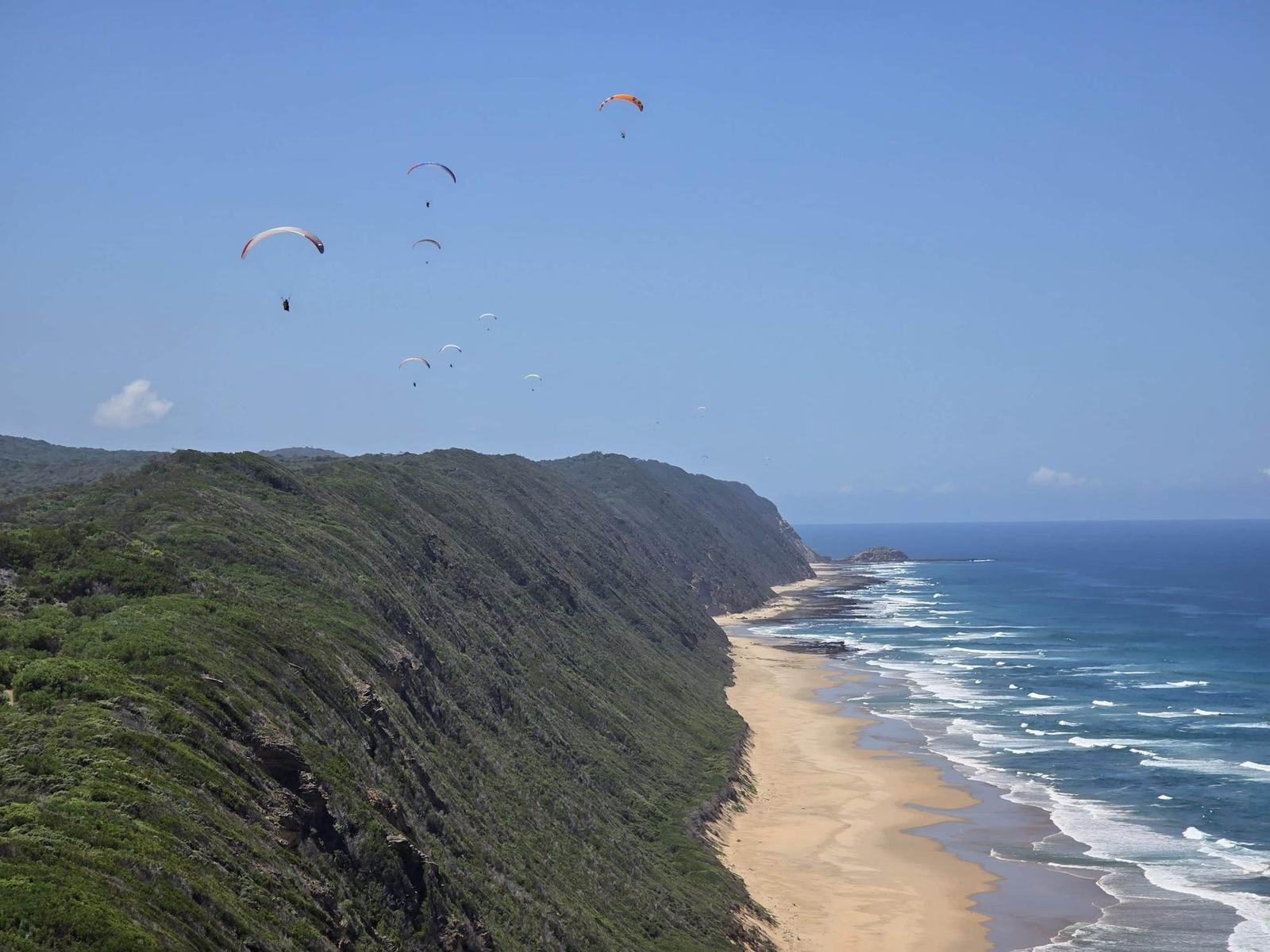
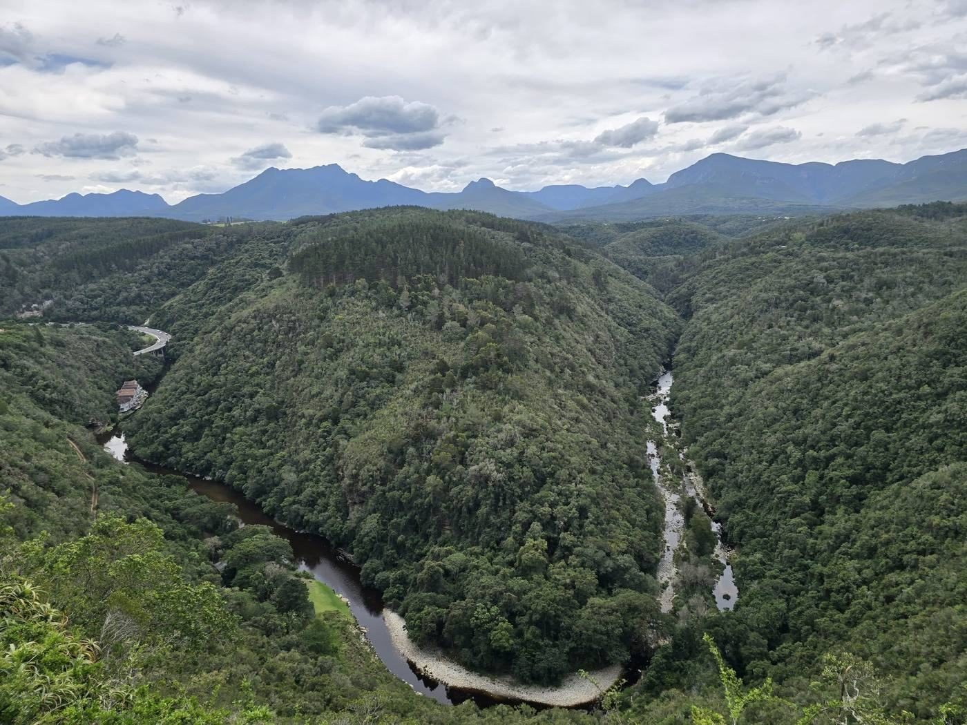
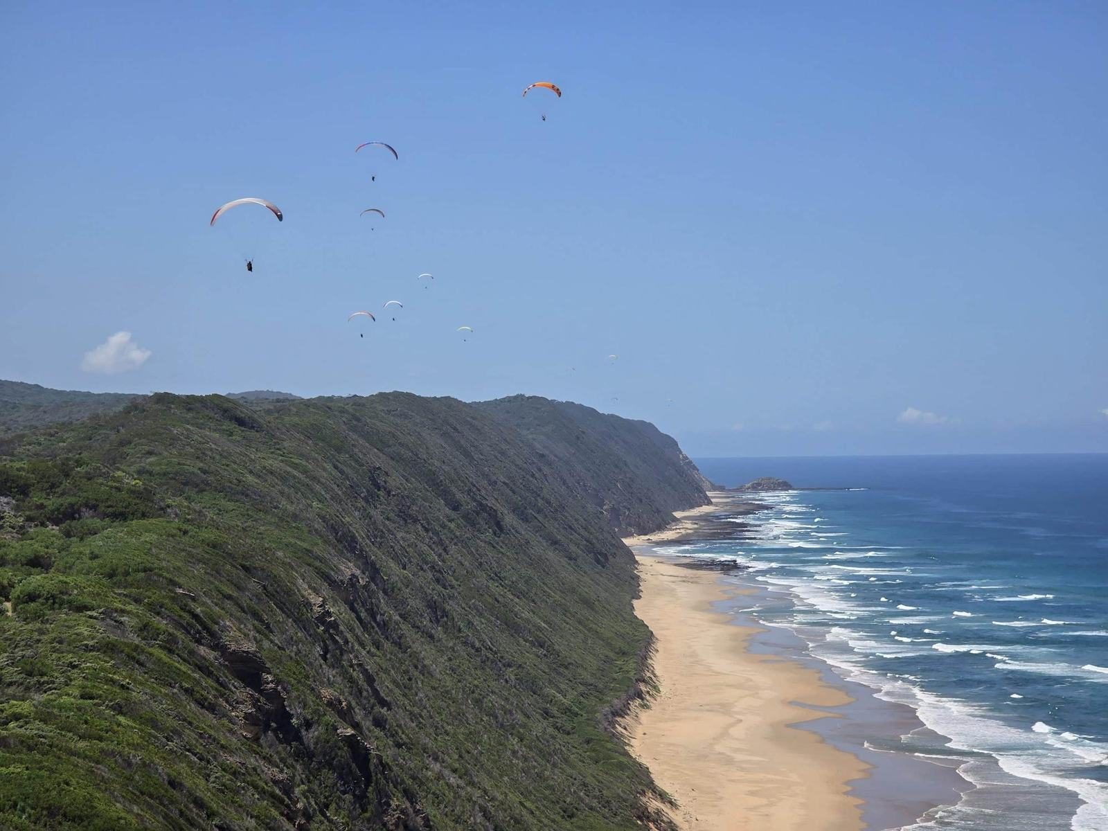
Stand at the Map of Africa on a summer afternoon and you will see them before you hear them: five, ten, sometimes twenty wings hanging over the edge of the ridge, barely moving, while the sea breeze pushes up the slope beneath them. Below is Wilderness Beach. Behind is the Kaaimans River gorge. It is one of the most beautiful places to fly in the world, and one of the easiest to watch.
This guide is for both kinds of visitor: people who want to try a tandem flight, and pilots bringing their own wing.
Why Wilderness is so good for flying
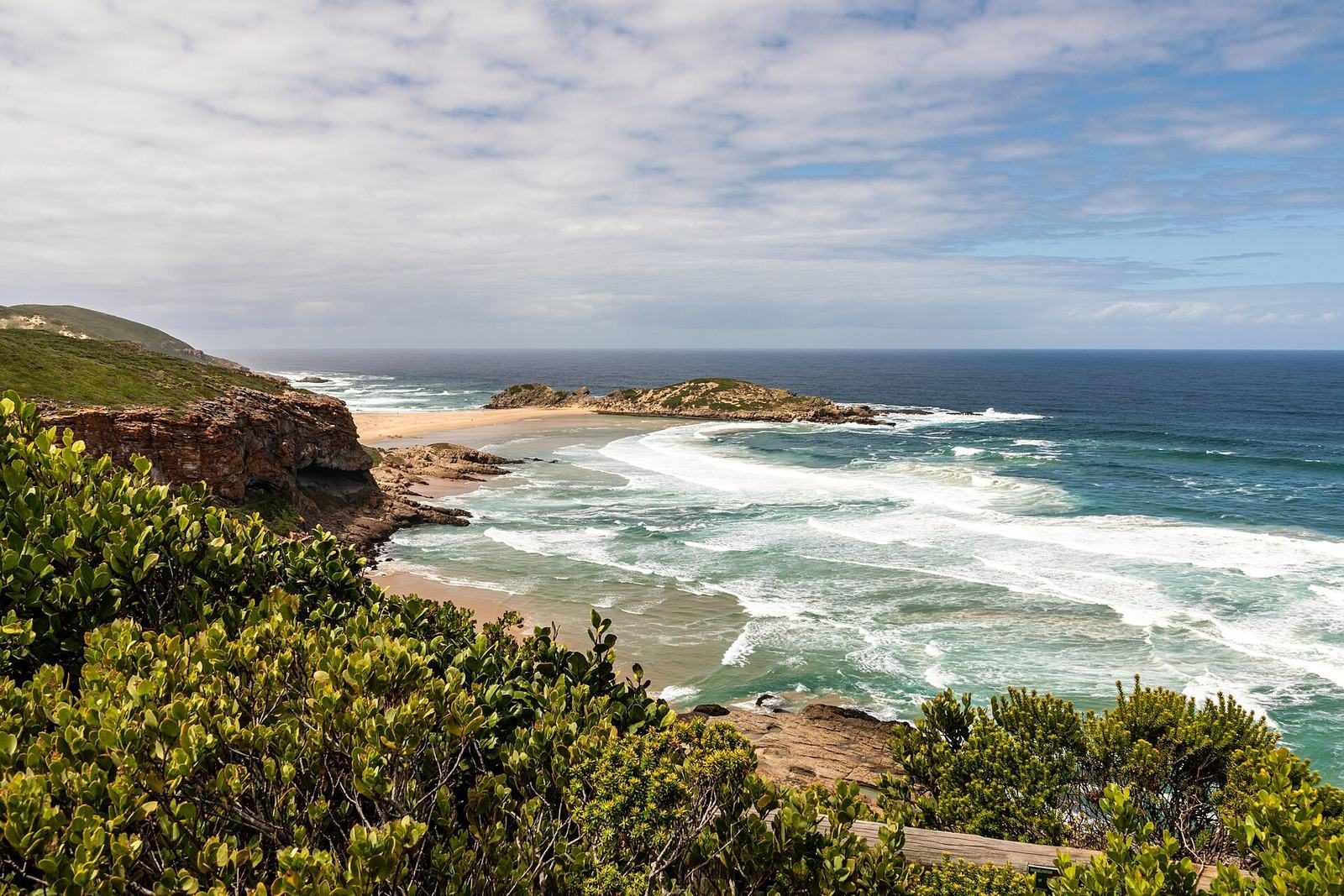
The Garden Route coast is a long series of vegetated dunes and ridges facing the Indian Ocean. On most summer days the land heats up faster than the sea and a steady sea breeze blows onshore from the south or south-east. When that breeze meets a ridge, it rises, and a paraglider can soar the lift for as long as the wind holds.
Wilderness sits right in the middle of this. Local school Cloudbase Paragliding counts 24 flying sites within an hour's drive, from gentle training dunes to inland thermal sites. The combination of reliable coastal soaring, soft beach landings and spectacular scenery is why pilots come from Europe every southern summer.
The main sites around Wilderness
Site details change and many launches are on private land. Always get a local briefing and check the current SAHPA site guide before flying.
| Site | Where | Wind | Character |
|---|---|---|---|
| Map of Africa | Ridge above Wilderness | S to SE | Mellow ridge soaring over the beach; launch about 120 to 150 m above sea level |
| Kleinkrantz | Dunes east of Wilderness | SW to S | Low training dune, beach landing |
| Paradise Ridge | East of Kleinkrantz | Onshore | Longer ridge runs, connects with Kleinkrantz |
| Serpentine | One ridge back from the coast | Varies | Trickier, more cross-country potential; experienced pilots |
| Sedgeview (Sedgefield) | Above Sedgefield | Onshore | Surprisingly thermic, top-landing possible |
| Brenton-on-Sea | West of Knysna | S to SW | Long ridge along the beach |
| Gericke's Point | Sedgefield coast | Onshore | Classic coastal soaring with views of the point |
The Map of Africa
The signature site. You launch from a grassy slope next to the viewpoint and soar the forested ridge above Wilderness Beach, with the whole coastline laid out below. According to the SAHPA site guide, it works best in south to south-easterly winds; south-westerlies curl around the ridge and become turbulent, and a sea covered in whitecaps means it is too strong.
Rules pilots need to know:
- You must be a SAHPA member, and the site is managed by a local club that collects a site fee.
- Notify George air traffic control before flying. The airport lies to the north-west and its controlled airspace starts just across the Kaaimans River, so do not fly west over the gorge.
- Land on the beach, well away from swimmers. In peak season, land east of the rocks that bound the first beach section.
- Stay clear of houses and power lines to the west and north of launch.
For walkers and spectators, the Map of Africa viewpoint guide explains how to get there.
Kleinkrantz and Paradise
Kleinkrantz is a low dune site on the coast east of Wilderness where many students take their first soaring flights. The SAHPA guide asks pilots not to use the top launch there because of ecological sensitivity. To the east, Paradise Ridge offers longer runs along the coast on the right day.
Sedgefield
Twenty-five minutes east, Sedgefield has several sites, including Sedgeview above the town, which is more thermic than its size suggests, and the coastal soaring at Gericke's Point.
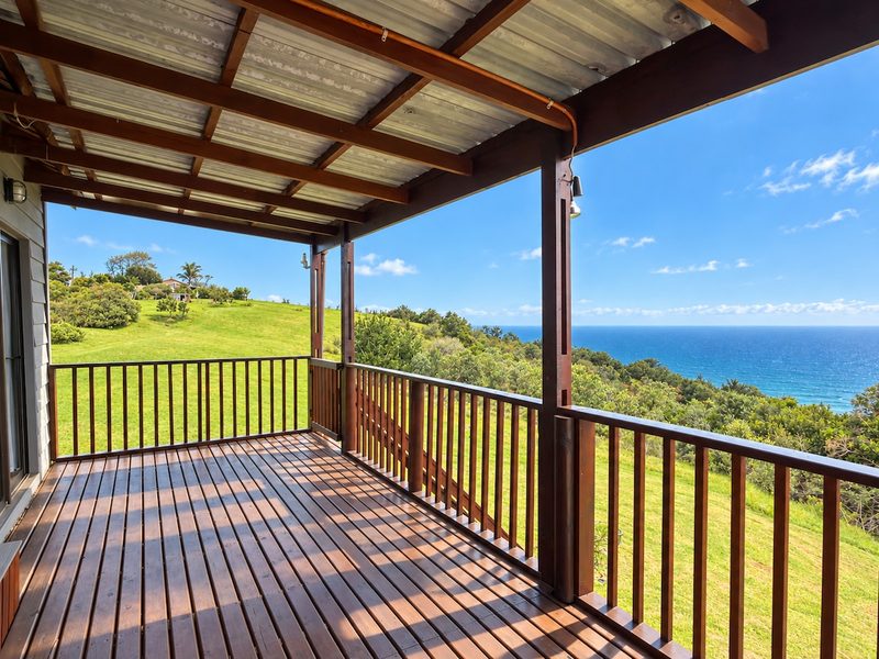 Wohnen, wo diese Geschichte spieltWake up right next to the Map of Africa launch.Drei Selbstversorger-Unterkünfte auf 21 Hektar über Wilderness. Direkt buchen zum besten Preis.Daten prüfen →
Tandem flights: flying without experience
You do not need any training to fly. A tandem flight puts you in a harness in front of a qualified pilot who does all the work. Most flights at the Map of Africa last somewhere between 10 and 30 minutes, depending on the conditions, and end with a soft landing on the beach.
What it costs: tandem flights in Wilderness start at roughly R850 for a standard flight and go up to about R1,500 for a longer one. Photo and video packages usually cost extra.
What to bring: sturdy closed shoes, a long-sleeved top and sunglasses. The pilot supplies the helmet and harness.
How booking works: tandems are weather-dependent, so operators usually confirm on the day. Book a provisional slot early in your stay, not on your last afternoon, so there is time to reschedule if the wind does not cooperate.
Who flies tandems and teaches here
Wilderness has several established schools, and they all fly the same ridges. We do not work with one exclusively. In alphabetical order:
| School | What they offer |
|---|---|
| Cloudbase Paragliding | Tandem flights and courses; flying from Wilderness since 1995 |
| Let's Fly Paragliding | Tandem flights from the Map of Africa |
| MountAIR Paragliding | Tandem flights, paragliding courses and parakite training in Wilderness and Sedgefield |
| Paraglide Africa | Tandem flights, courses, guided tours and gear |
| Wild2Fly | Paragliding, hang-gliding and parakiting; Wilderness and Sedgefield |
Whoever you fly with, ask whether the pilot holds a current SAHPA tandem rating.
Learning to fly
Wilderness is one of the best-known places in the world to learn. The schools above offer everything from a one-day introduction to a full basic licence, which usually takes 10 to 14 days if the weather plays along. The dunes at Kleinkrantz and the ridge at the Map of Africa are forgiving training sites, and the beach makes landings easy.
If you want to learn, plan at least two weeks so you have spare days for wind.
Parakiting: the place to learn it
Parakites are small, fast wings built for strong wind, somewhere between a kite and a paraglider. They let you soar the dunes and ridges on days when it is too windy for a normal paraglider. With its steady sea breeze, soft sand and long coastal ridges, the stretch between Wilderness and Sedgefield is South Africa's hotspot for learning to parakite.
Learn with MountAIR. MountAIR Paragliding runs parakite training in Wilderness and Sedgefield with SAHPA-accredited instructors, alongside its paragliding courses and tandem flights. If parakiting is why you are coming, start there.
When to fly
- October to April brings the most reliable sea breezes and the most flyable days. This is peak season for visiting pilots.
- Winter (June to August) can deliver beautiful, smooth days, but frontal systems and north-westerly winds shut the coastal sites down more often.
- Time of day: coastal sites usually switch on from late morning once the sea breeze sets in, and many of the best flights are in the late afternoon light.
- Bonus: from June to November, pilots regularly spot southern right whales from the air. Some tandem pilots even advertise whale spotting from the air.
Tips for visiting pilots
- Bring your SAHPA membership (temporary foreign memberships are available through SAHPA) and your licence.
- Buy a local SIM or eSIM for weather apps and the local WhatsApp groups where pilots share conditions.
- Watch the water. Cat's paws on the sea and white horses are your early warning for gusts.
- The surf here is powerful. Never land close to the water's edge.
- Respect the landowners and the neighbours. Access to several sites depends on goodwill.
Häufige Fragen
Can beginners paraglide in Wilderness?
Yes. Tandem flights need no experience at all, and local schools offer introduction courses and full licence training on the dunes and ridges around Wilderness.
Where can I learn parakiting in South Africa?
Wilderness and Sedgefield on the Garden Route are the hotspot. MountAIR Paragliding runs parakite training there with SAHPA-accredited instructors; Wild2Fly also teaches parakiting.
How much does a tandem paragliding flight cost on the Garden Route?
Tandem flights in Wilderness start from about R850 for a standard flight and go up to about R1,500 for a longer one. Photo and video packages cost extra. Check current prices with the operator.
What is the best time of year for paragliding in Wilderness?
October to April, when onshore sea breezes are most reliable. Winter has fewer flyable coastal days but can be very smooth.
Where do paragliders land at the Map of Africa?
On Wilderness Beach below the ridge, away from swimmers. There is a forest path back up to the car park.
Do I need permission to fly the Map of Africa as a visiting pilot?
You need SAHPA membership, a site briefing from the local club, and you must notify George air traffic control before flying.
Wir leben an der Garden Route und aktualisieren diesen Guide jede Saison. Etwas hat sich geändert? Sag es uns.