Wilderness
The Map of Africa viewpoint: sunrise, paragliders and how to get there
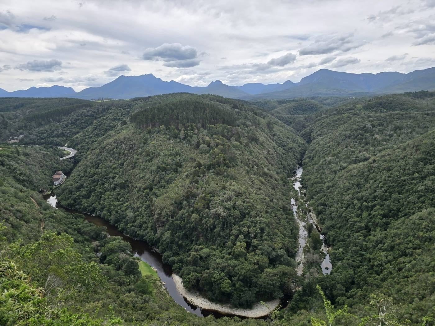
A bend in a river that happens to trace a continent, a grassy launch for paragliders, and one of the finest sunrise spots on the Garden Route. Ten minutes from the village, right next door to us.
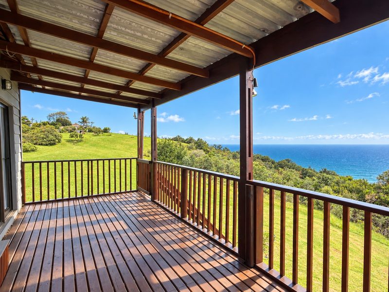
Ecoresort Wilderness is right next door to the viewpoint.
The short answer
The Map of Africa is a viewpoint on the ridge above Wilderness on South Africa's Garden Route, where a loop of the Kaaimans River, seen from above, traces the outline of the African continent. It is free, reached by a short drive up from Wilderness village, and is also one of the region's best-known paragliding launches. The best light for the river is early morning; the best time to watch paragliders is a summer afternoon with a south-easterly breeze.
- Where
- Ridge above Wilderness, west of the village
- Cost
- Free
- Time needed
- 20 minutes to a whole afternoon
- Best light
- Sunrise and early morning
- Also
- Paragliding launch, forest walks, coastal views
In this guide
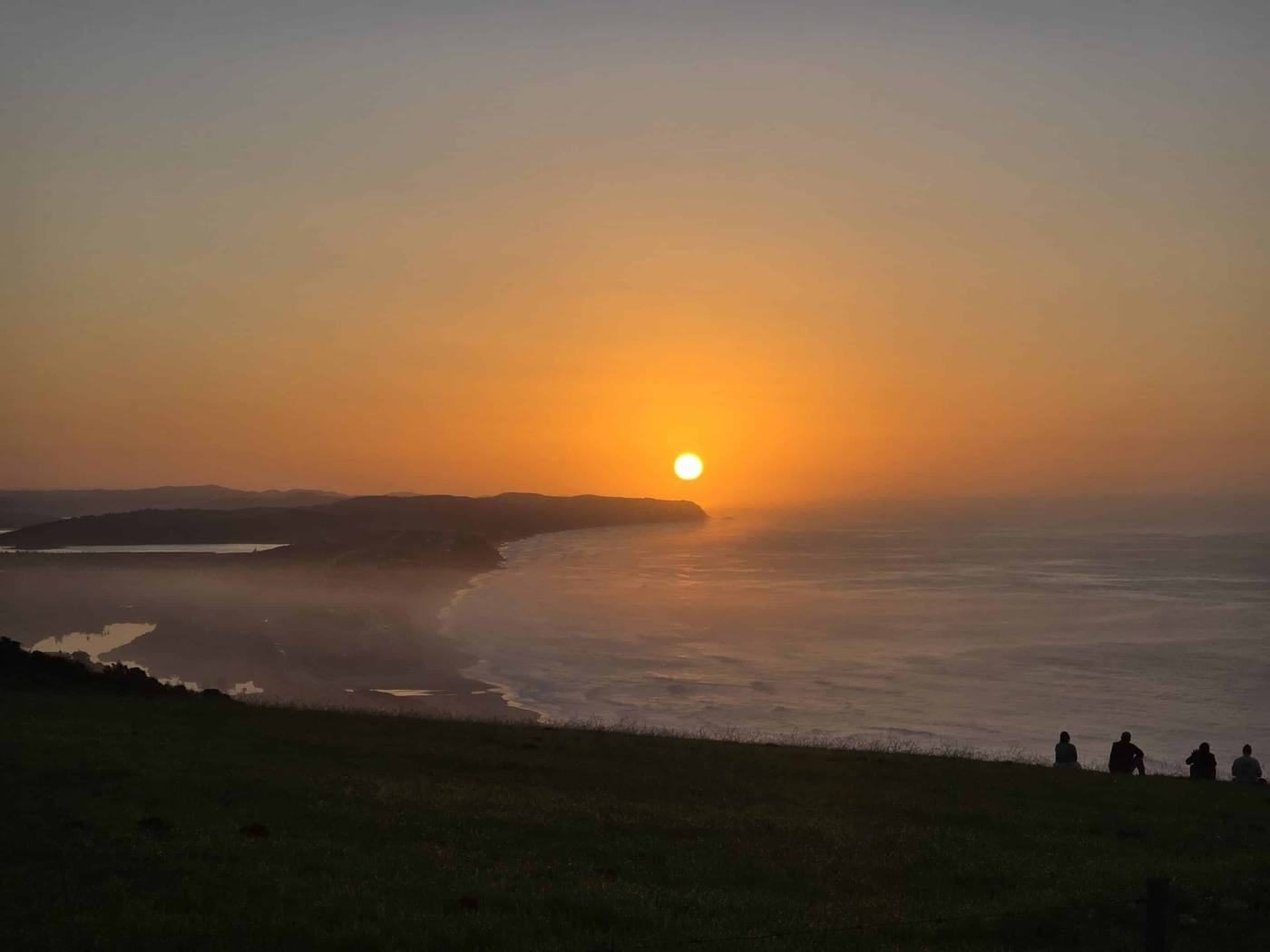
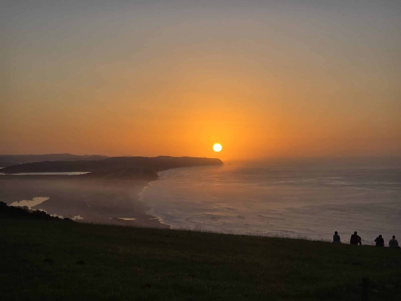
There is a moment, a few minutes after sunrise, when the light comes over the hills behind Wilderness and fills the Kaaimans gorge from the top down. The forest turns from black to green, the river from grey to silver, and the shape you came to see appears: a loop of water drawing the outline of a continent, the Horn of Africa pointing north-east, the Cape at the bottom.
It is worth setting an alarm for.
What is the Map of Africa?
The Kaaimans River runs down from the Outeniqua Mountains to the sea just west of Wilderness. Over a very long time it has cut a deep, forested gorge and, in one place, made a tight meander around a spur of land. From the ridge above, that spur and the river around it look remarkably like a map of Africa.
The viewpoint sits on the edge of the ridge, at the top of steep indigenous forest. Turn your head from the river and you look straight down the coast: the Kaaimans mouth, Wilderness Beach and, on a clear day, the headlands towards Sedgefield.
How to get there
The viewpoint is signposted from Wilderness village and is about a ten-minute drive.
- From the N2, take the turn-off into Wilderness village.
- Follow the road towards the Wilderness Hotel and continue up the hill into Wilderness Heights.
- Keep climbing until you see the brown "Map of Africa" sign, then follow the road along the ridge to the parking area at the viewpoint.
The last stretch is a gravel road that is fine for any normal car in dry weather. Drive slowly, it is shared with walkers, cyclists and people carrying paragliders.
On foot: Fit walkers can hike up from the village through Wilderness Heights. Allow about an hour, most of it uphill.
From our place: right next door. The paragliding launch is about 220 metres from our cottage.
When to go
| Time | What you get |
|---|---|
| Sunrise | The river shape is clearest in soft morning light, with mist in the gorge on cool days |
| Midday | Harsh light and haze. Good for the coastal view, less for the river |
| Afternoon, Oct to Apr | Paragliders, when the south-easterly sea breeze is blowing |
| Sunset | Warm light on the coast and mountains; the gorge falls into shadow early |
| Jun to Nov | Scan the sea for southern right whales |
In winter the sun rises around 07:30, in summer before 05:30. Check the time the night before and give yourself ten minutes to find your spot.
Watching the paragliders
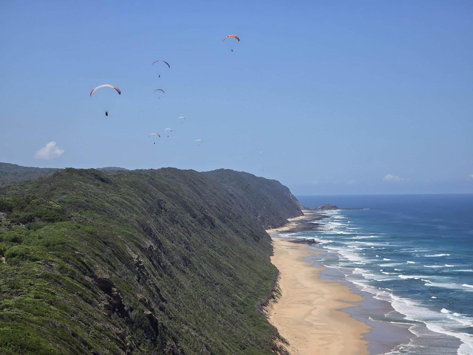
The Map of Africa is one of South Africa's best-known paragliding sites. On days with a gentle south to south-easterly breeze, pilots launch from the grass right beside the viewpoint and soar the ridge above the beach, sometimes for hours. It is a lovely thing to watch with a picnic.
Want to join them? Tandem flights with local pilots need no experience and land on the beach below. See our paragliding guide for operators, prices and seasons.
Please keep the launch area clear, keep children and dogs off the take-off slope, and do not fly drones when paragliders are in the air.
 Stay where this story happensSleep right next to the view. Watch the sunrise with coffee in hand.Three self-catering places on 21 hectares above Wilderness. Book direct for the best rate.Check dates →
Photography tips
- Lens: The river loop fills the frame at around 24 to 35 mm on a full-frame camera. A phone's standard lens works well.
- Position: Walk a few metres along the edge until the "continent" is fully visible. Do not climb over the barrier; the slope is steep and unstable.
- Mist: Cool, still mornings after rain often fill the gorge with low cloud. Wait, it lifts quickly and the first reveal is spectacular.
- Drones: Check the rules before flying. The area is close to George Airport's controlled airspace, and paragliders use the ridge.
What else to do on the ridge
- Walk the forest edge. Gravel roads and paths run along the ridge through a mix of indigenous forest and fynbos. Early in the morning you may see bushbuck grazing at the forest edge and hear Knysna turacos in the trees.
- Watch the train line. The old railway runs along the coast below and crosses the Kaaimans mouth on its heritage-listed bridge. If the Choo Tjoe revival reaches Wilderness, this will be one of the best places to watch a steam train cross.
- Go down to the beach. The beach below is where the paragliders land. The forest path from the car park leads down to it.
Frequently asked questions
Why is it called the Map of Africa?
Because a meander of the Kaaimans River, seen from the ridge above, forms the outline of the African continent.
Is there an entrance fee at the Map of Africa?
No. The viewpoint is free and open at all times.
How long do you need at the Map of Africa?
Twenty minutes is enough for the view and photos. Stay longer on a paragliding afternoon, or come for sunrise.
Can you paraglide from the Map of Africa?
Yes. It is a well-known launch. Beginners can fly tandem with a qualified local pilot; solo pilots need SAHPA membership and a site briefing.
Is the road to the Map of Africa suitable for normal cars?
Yes, in dry weather. The final section is gravel. Drive slowly and watch for walkers.
We live on the Garden Route and update this guide every season. Something changed? Tell us.